THE SIGNAL IN ONE SENTENCE
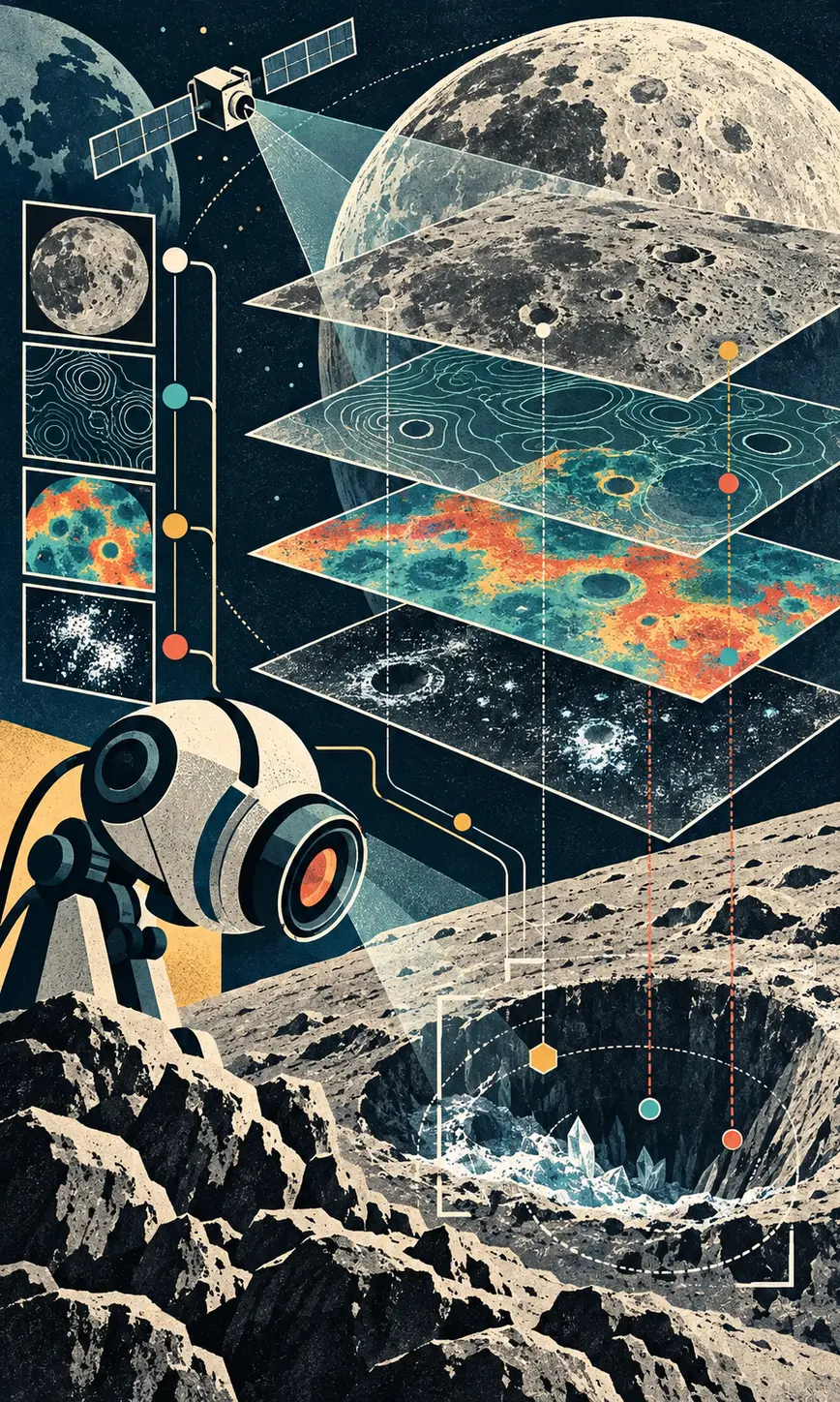
NASA and IBM released a reusable AI model trained on layered maps of the Moon. Researchers can adapt it to find craters, study unusual volcanic terrain, and estimate where ice may remain near the poles without starting every project from an empty model.
01
WHAT ACTUALLY CHANGED
On September 10, NASA and IBM released the NASA-IBM Lunar Foundation Model, a public model built specifically for lunar remote sensing. The release includes model weights on Hugging Face, Apache-2.0-licensed fine-tuning and inference code on GitHub, downstream task models, machine-learning-ready datasets, and benchmark collections. That last part matters. An open checkpoint without the data and evaluation path is a science kit with half the screws missing.
The model learned from roughly two million image tiles. NASA says the collection includes more than one million high-resolution camera images at one-meter resolution and nearly 964,000 multispectral images at 100-meter resolution. IBM describes the broader training set as more than 30 spatially aligned layers from nine instruments across four missions, drawing heavily from NASA's Lunar Reconnaissance Orbiter and adding data from GRAIL, Lunar Prospector, and Japan's SELENE mission.
Instead of training a separate visual system from scratch for every question, a scientist can fine-tune this shared backbone with a smaller labeled dataset. The published tasks cover crater detection, segmentation of irregular mare patches, and ice prospectivity near the lunar poles. Those are different jobs, but each depends on understanding how terrain, illumination, composition, and scale fit together across maps that were never designed as one tidy spreadsheet.
The authors report the clearest advantage on polar ice prospectivity. IBM says the model reduced root mean square error by as much as 22 percent against a SwinV2-B baseline. At roughly 100-meter context scale, it improved crater detection by nearly 19 percent while using half the training data. It was comparable to strong baselines on meter-scale crater mapping and slightly better at tracing irregular mare patches. These are task-specific author benchmarks, not a universal score for understanding the Moon.
NASA also demonstrated a useful kind of novelty test. Researchers excluded an image taken after a rocket-body impact from pre-training, then fine-tuned the model to compare before-and-after observations. The system highlighted the new crater while detecting older ones. That suggests a path toward faster change detection across enormous archives, although NASA warns that different lighting conditions can make smaller craters harder to see.
02
WHY THIS MATTERS
Lunar science has the opposite problem from a startup begging for data. NASA has spent decades collecting an extraordinary record, and the pile is now too large and heterogeneous for people to inspect one image at a time. A reusable model can move the expensive first step from assembling pixels toward asking better geological questions.
Potential ice is not merely an interesting blue patch on a map. Ice can preserve evidence about lunar history and may eventually supply water, oxygen, or ingredients for propellant. A model cannot certify a resource deposit from orbit, but it can help researchers rank places for closer observation and reduce the amount of cold, dark terrain that must be searched blindly.
Crater maps affect both history and hardware. Scientists use crater counts to estimate the age of terrain, while mission planners care about slopes, boulders, impact risk, and safe routes. Faster mapping can help both groups, provided the model's confidence is carried into the decision instead of being polished into a false yes-or-no answer.
The open release makes the project more useful outside the original team. Researchers can inspect the weights, run published task configurations, compare new methods on shared benchmarks, and adapt the backbone to questions the launch team did not choose. The GitHub repository does not include pre-training code, however, so the release is reproducible for fine-tuning and evaluation more than it is a complete recipe for rebuilding the foundation model from raw observations.
There is a larger signal here for scientific AI. General chat models get the headlines, but domain models can earn their keep by aligning stubborn archives, preserving spatial structure, and giving specialists a common starting point. The win is not a machine declaring that it understands the Moon. It is a scientist spending less time wrangling tiles and more time testing a claim about an actual crater.
03
WHERE IT COULD HELP
- Rank polar regions for follow-up observations of possible stable ice
- Map craters at multiple scales for geology, hazard analysis, and route planning
- Segment irregular mare patches to study the Moon's volcanic and thermal history
- Detect surface changes by comparing observations taken at different times
- Fine-tune a shared lunar backbone for new remote-sensing tasks with fewer labels
KEEP A HAND ON THE WHEEL
The performance figures come from NASA and IBM and should be tested independently on new regions, instruments, lighting conditions, and mission tasks. Ice prospectivity is a model estimate, not proof of accessible water or a safe extraction site. A useful landing decision still requires instrument calibration, uncertainty analysis, terrain engineering, and on-site evidence. The GitHub repository supplies fine-tuning and inference code but explicitly says pre-training code is not included. Public weights and downstream code therefore do not make every stage of the original training run independently reproducible. Dataset licenses, compute requirements, geographic blind spots, and failure rates also need to be checked task by task.
04
TERMS WORTH KEEPING
SOURCES AND VERIFICATION STATUS
This article was written from the materials below. Product claims and dates were checked against those sources on September 11, 2026.
PUBLICATION RECEIPT: Revision 1. Published September 11, 2026.
THE PUBLICATION ENGINE
WANT A SIGNAL OF YOUR OWN?
We build source-grounded publications, private briefings, and editorial systems for organizations with something useful to say.
WORK WITH US